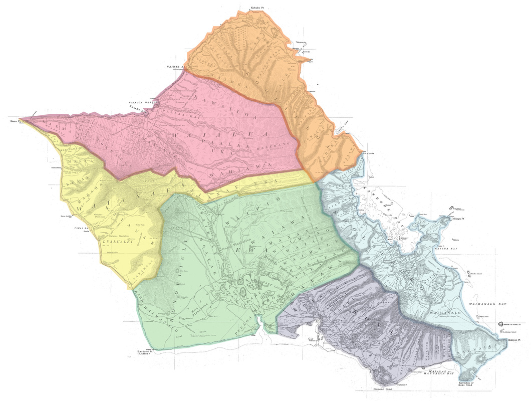
Oʻahu Map - HGS #2374 - 1902
Click on a moku from the map, or select a moku by clicking a button. For a list of ahupuaʻa names in each moku, see the table at the bottom of the page. To zoom in press "ctrl" & "+" , to zoom out press "ctrl" & "-"
| ||||||
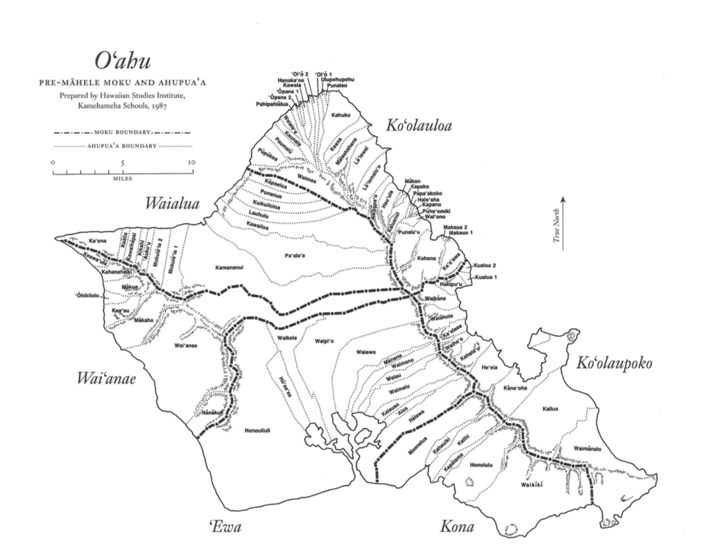
Oʻahu : Nā Ahupuaʻa Place names marked with an asterisk (*) represent ʻili divisions within ahupuaʻa
AVA Konohiki Maps, Photos and recent info about ahupuaʻa are arranged in a traditional Hawaiian way, by island, by moku, and by ahupuaʻa. In order to learn the wisdom of the ancestors, we walk in their footsteps. Understanding the land begins with the Makahiki procession which began on Oʻahu in the moku of Koʻolaupoko, in the ahupuaʻa of Kualoa. Makahiki was an annual religious ceremony that allowed the God Lono to make a clockwise circuit around the island to bless the land with fertility, and to ensure that each of the 81 ahupuaʻa were planted most efficiently with food.
So we, the AVA Konohiki, follow in their footsteps with the 6 Moku districts listed, beginning with Koʻolaupoko and going in a clockwise direction back to Kualoa, the starting point. These are: Koʻolaupoko, Kona, ʻEwa, Waiʻanae, Waialua, and Koʻolauloa. In a similar fashion, the ahupuaʻa in each moku are not listed in alphabetical order. They are listed in geographical order, because that is how the ancestors thought of them, and that is how we, their descendants, should learn them, too. Hence, if you want to do research on an Oʻahu ahupuaʻa, or call up it's map, you need to look for what moku district it is in and then look for what ahupuaʻa are on its boundaries. Have fun! |


