AVAKonohiki.org
  • Brandt Mini-Symposium
  • About AVA
    • *AVA New* >
      • Poepoe
      • New Maps - Upload Form
      • Mana's Māla Blog
      • AVA Graduates
      • Events >
        • Past Events
    • AVA Paths
    • Tutorial Videos
    • Contact Us
    • Partners
    • AVA Team
    • Website Development
    • Volunteers
  • Lilikala Videos
  • Land & Map Research
    • Oʻahu >
      • Maps Ko'olaupoko >
        • Koʻolaupoko >
          • Kāneʻohe & Mōkapu
          • Waimanalo >
            • Young Scholars of Waimanalo
      • Maps Kona >
        • Kona >
          • Kalihi >
            • Kalihi: Fishponds
            • Kalihi: Landscape During the Mahele
            • Kalihi: Maps
      • Maps 'Ewa >
        • ʻEwa
      • Maps Wai'anae >
        • Waiʻanae
      • Maps Waialua >
        • Waialua
      • Maps Ko'olauloa >
        • Koʻolauloa >
          • Kahana
          • Kahuku
    • Maui
    • Molokaʻi
    • Kahoʻolawe
    • Hawaiʻi >
      • Kona Maps
      • Kaʻū Maps
      • Waiākea >
        • Maps
      • Waipio
    • Map Index
  • Hawai'i Land Documents
    • Buke Mahele
    • Foreign Testimonies >
      • FT Advanced Search
      • FT Index
      • FT Book 1
      • FT Book 2
      • FT Book 3
      • FT Book 4
      • FT Book 5
      • FT Book 6
      • FT Book 7
      • FT Book 8
      • FT Book 9
      • FT Book 10
      • FT Book 11
      • FT Book 12
      • FT Book 13
      • FT Book 14
      • FT Book 15
      • FT Book 16
    • Native Testimonies >
      • NT Book 1
      • NT Book 2
      • NT Book 3
      • NT Book 4
      • NT Book 5
      • NT Book 6
      • NT Book 7
      • NT Book 8: not available
      • NT Book 9
      • NT Book 10
      • NT Book 11: Not Available
      • NT Book 12
      • NT Book 13
    • HSHK Knowledge Well
    • Other Resource Sites
  • LCA Index & Search
    • LCA Advanced Search
    • LCA Index
    • LCA Book 1
    • LCA Book 2
    • LCA Book 3
    • LCA Book 4
    • LCA Book 5
    • LCA Book 6
    • LCA Book 7
    • LCA Book 8
    • LCA Book 9
    • LCA Book 10

Picture

"Ola Waiʻanae i ka makani Kaiaulu."
"Waiʻanae is made comfortable by the Kaiaulu breeze."
- ʻŌlelo Noʻeau #2495, pg. 272 (Pukui 1983)

Click here for Maps 

"Ku kapakahi ka la ma Wai'anae," first uttered by Hi'iaka as she reffered to the favoritism of the sun to Wai'anae.  The moku of Wai'anae is situated on the western side of O'ahu with Waialua to the northeast and 'Ewa to the southeast.  It is comprised of 8 ahupuaa and stretches from the Keawa'ula side of Ka'ena Pt. to the ridge of Manawahua in Nānākuli.  Waiʻanaeuka also stretches over Kolekole pass and reaches all the way to Pu'u Ka'aumakua where it meets the Ko'olau range.  Despite the intense heat, there was an abundance of water via streams and springs in this district, and it still possesses great potential to be a major contributor of food production on O'ahu.  The summit of Ka'ala, the tallest point on O'ahu,  also sits as a piko (center) of Wai'anae.

Picture
Waiʻanae Moku - HGS# 2988 - 1925
waianaemoku_rm2988_1925.tiff
File Size: 1225 kb
File Type: tiff
Download File

Nā Ahupuaʻa o Waiʻanae

  1. Nānākuli
  2. Waiʻanae
  3. Mākaha
  4. Keaʻau
  5. ʻŌhikilolo
  6. Mākua
  7. Kahanahāiki
  8. Keawaʻula

Picture
Kepuhi Pt. from Keawa'ula - Waiʻanae - Photo by Wahine'aipohaku Tong
Picture
Kahanahāiki - Waiʻanae - Photo by Wahine'aipohaku Tong
Picture
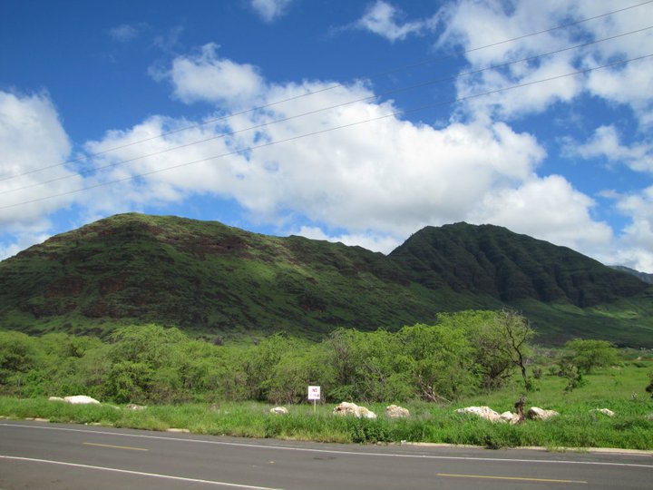
Pu'u Kamaile, Wai'anae - Photo by Wahine'aipohaku Tong
Picture
Pu'u Kaua - Lualualei Valley - Photo By Wahine'aipohaku Tong
Picture
Kai momona - Photo by Wahine'aipohaku Tong
Powered by Create your own unique website with customizable templates.